For Farming

A soil map of every field
without the sampling crews

We give you a field-level picture of soil health across your whole area, and track how it changes over time, without sending anyone into the field. All from satellite data, at a fraction of the cost of traditional sampling.
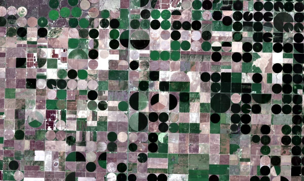
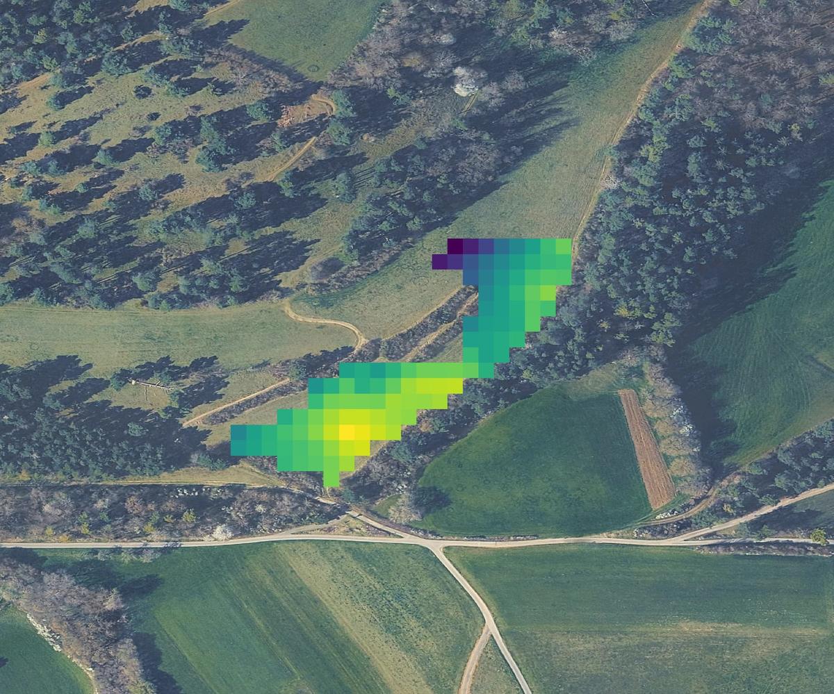
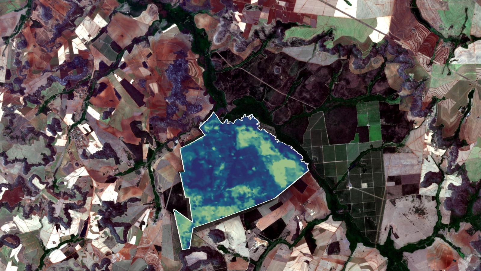
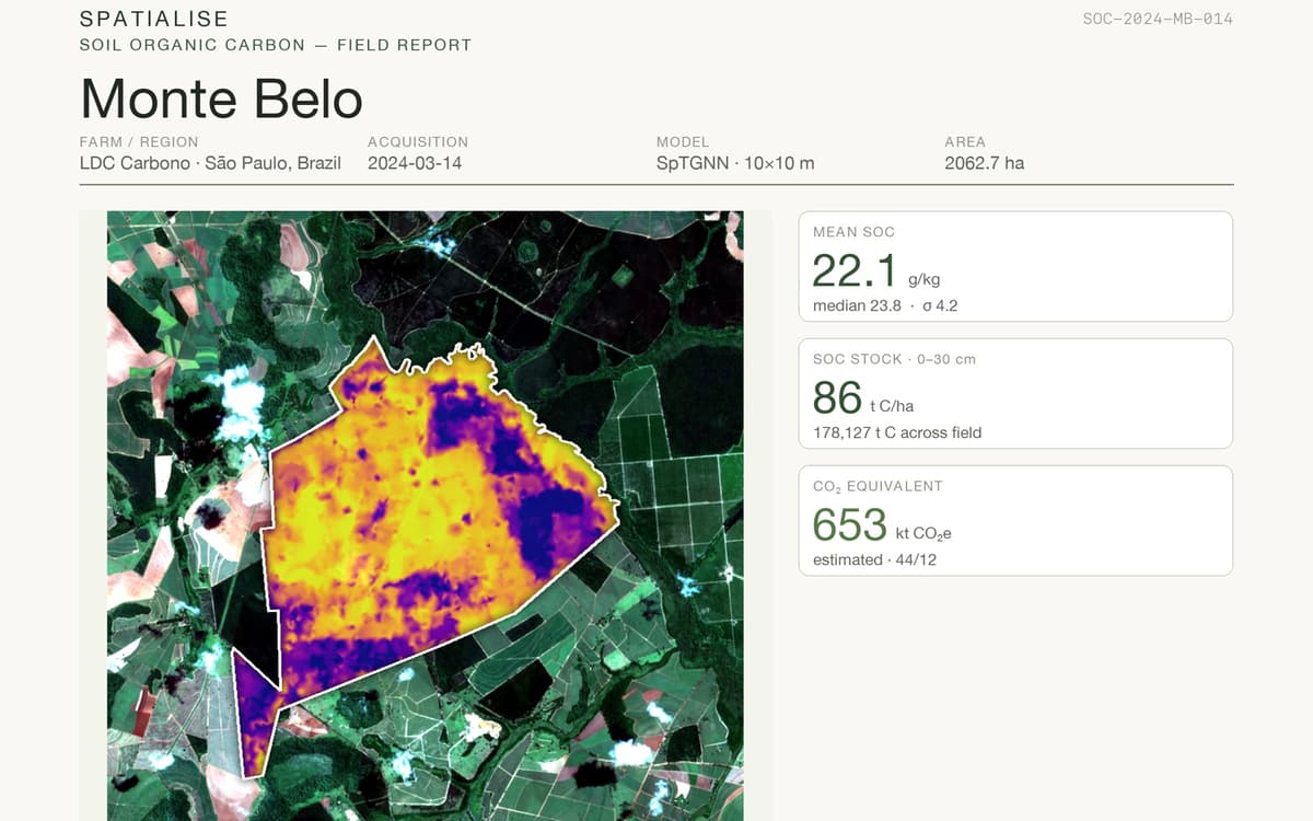
Wall-to-wall soil health map over a farming programme area in Monte Belo, São Paulo
01The Problem

Soil is the one thing most programmes skip

Traditional soil sampling is slow, expensive, and covers only a few plots, so most farmland is never measured properly.

€15/ha

What traditional soil sampling costs per hectare, far too expensive to cover a whole programme.

6–8 weeks

The wait for lab results before anything useful reaches the farmer or the field team.

A few plots

Most programmes sample a handful of plots and extrapolate. Neither gives you a picture of every field.

02What You Get

Field-level answers, across the whole programme

Restoring fertility on degraded land is at the heart of regenerative and agroforestry work, whether you grow coffee, maize, soy, or cocoa. This is the soil intelligence that underpins it.

A wall-to-wall soil baseline

A wall-to-wall soil baseline

One picture of soil health across your whole programme area: every field, not a handful of sample plots extrapolated to the rest.

Change you can watch

Change you can watch

See soil fertility recover as your regenerative and agroforestry work takes hold, season after season, without anyone going into the field.

Claims your buyers can audit

Claims your buyers can audit

Give European buyers the traceable, deforestation-free, sustainably-sourced evidence they now ask for, backed by soil data, not paperwork.

The layer under your carbon case

The layer under your carbon case

If your programme carries a carbon component, our baseline-to-change measurements are the ground it stands on, ready for verification.

03How It Works

From satellite to soil map in 3 steps

01

We read your fields from space

We pull satellite imagery over your whole area, down to a 10×10m grid, so every field is covered, not just a few sample plots.

02

We check it against real ground samples

Our models are calibrated against 100,000+ lab-analyzed soil samples from 6 continents, so the maps hold up in the real world.

03

You get a soil map you can track

You receive a field-level soil health map you can act on today and revisit over time, ready to back up sustainability and carbon claims.

By the Numbers

0%+

Prediction Accuracy

0k+

Hectares Mapped

0

Continents

0k+

Soil Samples

0

Field Visits Needed

0×10m

Resolution

Platform

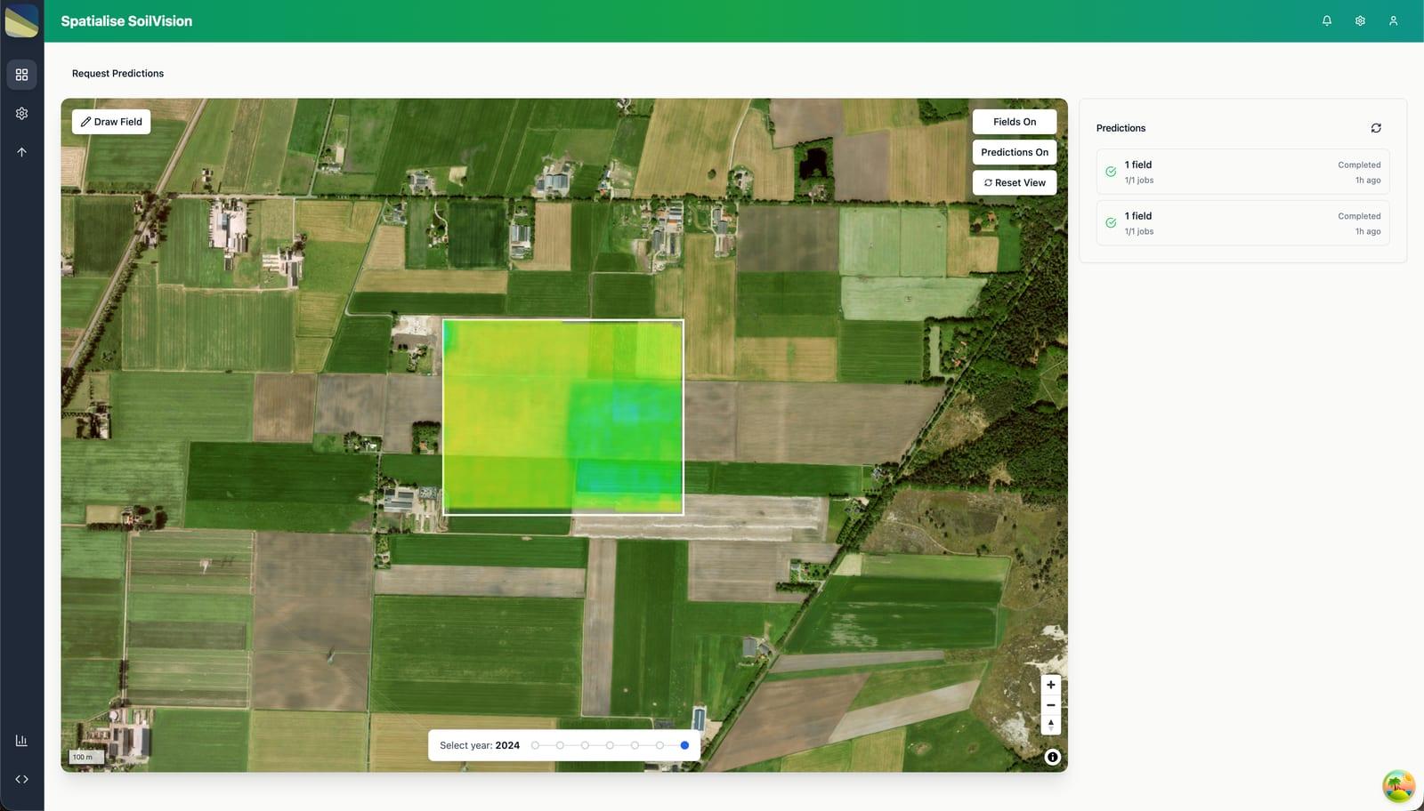
All your fields, one dashboard

Track soil health across every parcel, watch how it changes over time, and export the reports you need to back up sustainability and carbon claims.

Spatialise platform overview

Also from Spatiali.se

Strategic Partners & Collaborators

ESA
EUSPA
United Nations
The Landbanking Group
4 per 1000
Food Valley
StartLife
Startup Wageningen
Uniiq
World Soils
ESA
EUSPA
United Nations
The Landbanking Group
4 per 1000
Food Valley
StartLife
Startup Wageningen
Uniiq
World Soils
Team

Built by Domain Experts

Remote sensing scientists, ML engineers, and geospatial specialists working at the intersection of satellite data and earth science.

Soufiane el Khinifri

Soufiane el Khinifri

CEO

Daniele Mos

Daniele Mos

CTO

Anton Bossenbroek

Anton Bossenbroek

AI Advisor

Felipe Drummond

Felipe Drummond

Geospatial Engineer

Contact

Get in Touch

Interested in a pilot or partnership? Reach out and we'll respond within one business day.

Address

ESA SBIC, Kapteynstraat 1, 2201 BB, Noordwijk, The Netherlands

Hours

Mon - Fri: 9:00 - 17:00

We'll only use your details to reply to your enquiry.